The Guernsey Liberation Monument Print
Images and text copyright by David Le Conte (except as marked)
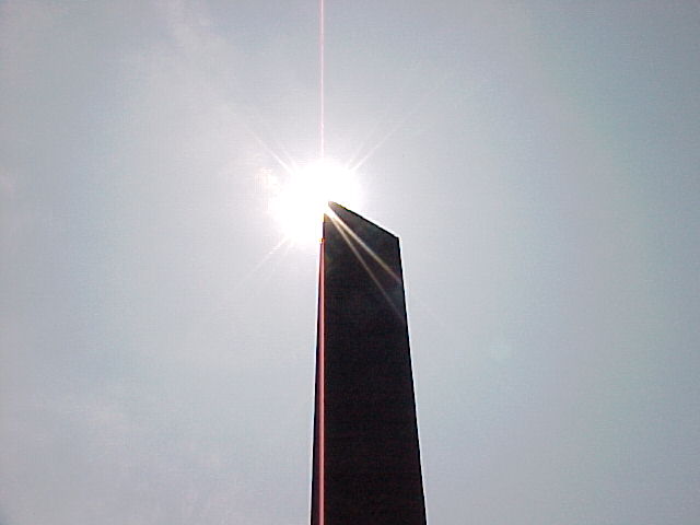
The Liberation Monument commemorates the 50th anniversary, on the 9th May 1995, of the Liberation of Guernsey from German occupying forces. It was designed by Guernsey artist Eric Snell, who was commissioned by the States of Guernsey. Interested in linking 1945 to 1995 and beyond, Snell looked to create a site-specific structure designed around the shadow cast by an obelisk. He worked closely with local astronomer David Le Conte of La Société Guernesiaise who carried out the necessary calculations and experiments. The tip of the shadow travels precisely (within one millimetre and 5 seconds of time) along the back of the curved granite seating on the 9th May, and only on that day. The shadow points to three inscriptions marking significant events on the day the island was liberated in 1945. Unveiled by HRH The Prince of Wales on Liberation Day, 1995, the obelisk is comprised of 50 layers of blue Guernsey granite, representing the 50 years of freedom, with the cut angle at the top representing the trauma of the occupation years.
Thousands of years ago Neolithic man erected stone monuments on Guernsey, placing them as precisely as they could, using the best technology available at the time. Some of them can still be seen - great stones providing a memorial to those ancient peoples.
These prehistoric monoliths were the inspiration for Guernsey artist Eric Snell, who was commissioned by the States of Guernsey to design a monument to commemorate the 50th Anniversary of the Island's Liberation from Second World War Occupation on the 9th May 1945. Eric said (June 1994): “I want to produce a piece of public sculpture (a monument) that obviously deals with issues from the past, but is also concerned with issues of today and the future. Something that hopefully has the possibility of being timeless. I want to create a place with a strong presence, evoking a sense of calm; an area of contemplation while at the same time looking to create a meeting place – a place to be enjoyed.”
The Guernsey Liberation Monument is precisely placed, using electronic age technology, to mark the path of the Sun on the 9th May 1995. The tip of the shadow of the 5-metre high obelisk falls on a curve of stone seating throughout the day, and provides a link between 1945, 1995, and each Liberation Day in the future.
The obelisk is made up of 50 layers of Guernsey granite - one layer for each year of freedom. The top layers are sheared away to represent the five years of occupation endured by islanders. The seating and platform are off-white French granite which enhances the visibility of the shadow cast by the obelisk.
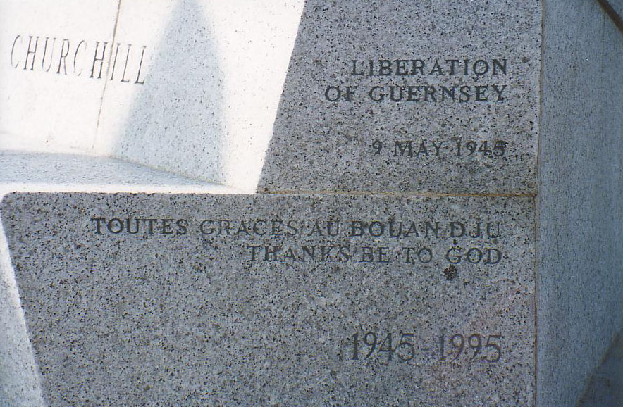
Inscriptions placed on the seating record the major events of the 9th May 1945: the signing of the surrender of the German forces at 7.15 am, the landing of the British Liberating Force at 8.00 am, and the unfurling of the Union Flag at 10.15 am. Also recorded is Winston Churchill's memorable statement: "Our dear Channel Islands are also to be freed today." At the east end of the seating the words "Thanks be to God" are inscribed in English and Guernsey-French.
The design of the Monument is not just specific to one day each year, but it is also unique to Guernsey. Nowhere else would the Sun cast a shadow in the precise curve at the precise times recorded by the inscriptions on the seating.
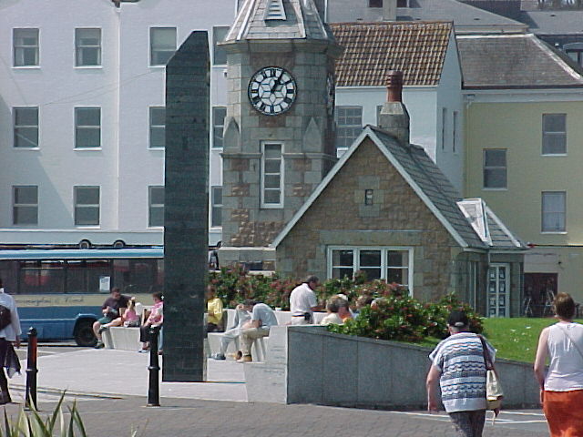
The Liberation Monument is in a location near the old Weighbridge Clock Tower at St Peter Port Harbour. It was in this area that islanders met the liberating forces in 1945 and rejoiced at their freedom. It provides a pleasant place to sit in the sun, facing precisely due south.
The Monument is designed and positioned within about a hundredth of a degree (approximately one millimetre), giving a precision of just a few seconds in time. The accuracy will change slightly in the future, because of the effect of leap years, weathering, settlement, and changes in the Earth's rotation and orbit. However, it should be reasonably accurate for several hundred years - but only on the 9th May!
The Liberation Monument was planned as the focus of the major celebrations commemorating the 50th Anniversary of the Liberation, on the 9th May 1995. A marriage of art and science, the Monument will provide a lasting commemoration of the Island’s Liberation.
The monument was designed by Guernsey artist Eric Snell, and erected by the States of Guernsey Liberation Day Committee. The cost of the Monument was defrayed by public subscription.
A Path of Precision
The large scale of the Liberation Monument, which covers an area of 500 square metres (it extends over 40 metres from west to east), and the fact that it is specific to just one day a year, gave the opportunity for high precision in the shadow path of the tip of the obelisk.
The mathematical calculations required were carried out by David Le Conte, a member of the local astronomy society, the Astronomy Section of La Société Guernesiaise, using a (BBC Basic) computer program which he wrote specifically for the purpose. The program, called SunShadow calculated the position of the Sun every five minutes, from 0640 to 1700 hours British Summer Time, for the 9th May 1995, to an accuracy of 1/100th of a degree, and converted the data to coordinates of the tip of the shadow, to an accuracy of just one millimetre.
However, a mathematical calculation alone is not good enough for practical application. Factors unnoticed in a small-scale sundial affect the apparent length of the shadow of a large-scale instrument, and hence the position of the observed shadow tip. It was important to take these effects fully into account so that the shadow was seen to fall exactly where it was intended.
SunShadow already allowed for atmospheric refraction, and long-term changes in the shadow length were taken into account through calculations covering several hundred years. Leap years make a difference of course, but there are also long-term variations in the apparent position of the Sun. Other effects include the fact that the Sun is not a point source of light, diffusion of the shadow because of atmospheric haze, and the need for the top of the obelisk to have a minimum bulk in order to cast an umbral shadow. Extensive experiments were carried out to determine the optimum height and shape of the top of the obelisk.
The Construction - a Monumental Task!
Precision designing of the Liberation Monument was one thing - precision construction was quite another. Rarely are architects required to build to an accuracy of one millimetre!
A detailed analysis was carried out into the potential for errors to creep in during construction: height and perpendicularity of the obelisk, level of the base platform and seating, orientation of the seating, accuracy of manufacture, and placing of the inscriptions. The one remaining factor which could affect the Monument‘s accuracy in the future is subsidence. Jacking points were built into the foundations of the obelisk so that, if necessary, it can be restored to its correct position.
The States of Guernsey Architect, Patrick Reade, was responsible for overseeing the construction, and Surveyor Sean Harvey was assigned the critical task of laying it out. The direction of True North had to be determined to within 1/100th degree, and, because of uncertainties in the accuracy of the map grid, this was done by checking the position of the Pole Star against Mica, the US Naval Observatory’s Interactive Astronomical Almanac.
The building of the Monument was carried out by LeRoy Limited, under the supervision of Phil Sebire. Great care was taken in the stone cutting and construction, with frequent survey checks. Starting in September 1994, it was completed in time for final checks of the shadow appearance and position, and a grand unveiling on the 9th May 1995, the 50th Anniversary of the Liberation, by HRH The Prince of Wales, in the presence of thousands of islanders and visitors, including veterans of the War and of the Liberation.
Each year on the 9th May the obelisk shadow silently commemorates the Liberation by following the precisely delineated path, the shadow tip pointing at the designated times to the inscribed events of 1945.
But the Monument serves a utilitarian, as well as a commemorative purpose. It is in a central location on the Harbour of St Peter Port, near the centre of the town, and adjacent to the departure point for boats to the other islands of the Bailiwick of Guernsey. On most days of the year it is thronged with people, enjoying the sunshine and surroundings. Many may be indifferent to the fact that they are sitting on a piece of the Island‘s history, but the unique design of the Liberation Monument creates tremendous interest and acknowledgement of Guernsey‘s troubled past, and that wonderful moment of freedom celebrated at this very spot over 50 years ago.
More stereoscopic images can be found here
A video of the shadow of the Monument can be found here (courtesy Euan Duncan)
In 1997 the Monument won a coveted Civic Trust Award.
Further information about the Monument appears in States of Guernsey Billet d'Etat XVII, 1994, and there are more pictures on Eric Snell’s website. A full report on the calculations of the shadow path and related data is lodged at the Guernsey Greffe. Papers describing its design and construction have been published in The Review of the Guernsey Society (Vol. LI, No. 2, Summer 1995, page 37), and the Bulletin of the British Sundial Society (No. 97.3, July 1997, page 43). The most detailed paper is in the Report and Transactions 1997 of La Société Guernesiaise (Vol XXIV, Part II, page 309). There are brief descriptions in Guernsey Sundials by David & Dorothy Le Conte (published by La Société Guernesiaise, 2004), Sundials of the British Isles (edited and published by Mike Cowham, 2005), and a leaflet (now out of print) issued by VisitGuernsey.
Guernsey Statutory Instrument 2005 No.5 prohibits skateboarding on the Monument.


